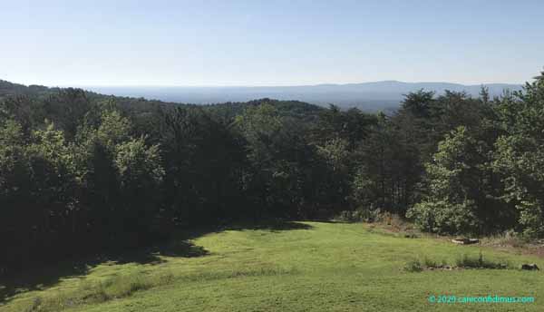
Leaving the grocery store Friday evening:
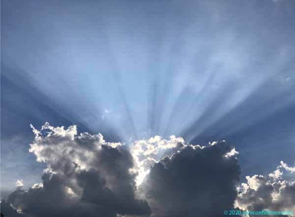
Leaving the grocery store Friday evening:
We had a strong but short thunderstorm Tuesday afternoon. A cold front moved through shortly after. When I got up Wednesday morning and looked out the front, this is what I saw.
At first I thought the fog was over the river, but then I realized that the Coosa River runs on the other side of the ridge just beyond the fog. This was not advection fog, this was radiation fog.
Radiation fog forms when the ground cools on a clear, calm night, causing moisture in the air to condense into fog. On Tuesday night, there was plenty of moisture in the air because of the shower, and the skies cleared with the passage of the cold front. Perfect conditions for forming fog. The fog also defines a temperature inversion, where the surface temperature is cool and the temperature actually goes up as you go up in altitude, the reverse of the normal conditions at the surface.
I took the photo above at around 8:20. By 9:30, this is what it looked like.
The for was gone. The bright sun had warmed the surface enough to erode the inversion, and the fog had cleared.
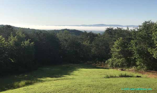
Saturday morning was overcast after an early morning light rain. Off in the distance we could see where the large Georgia Power Plant Bowen stacks stand. Bowen is one of the largest coal-fired power plants in North America.
Coal-fired power plants are almost always located on rivers because they use the river water for cooling. The Etowah River flows past the plant and then on through Rome, where it meets the Oostanaula River to form the Coosa River. If you look carefully at this photo, you can see where the river flows.
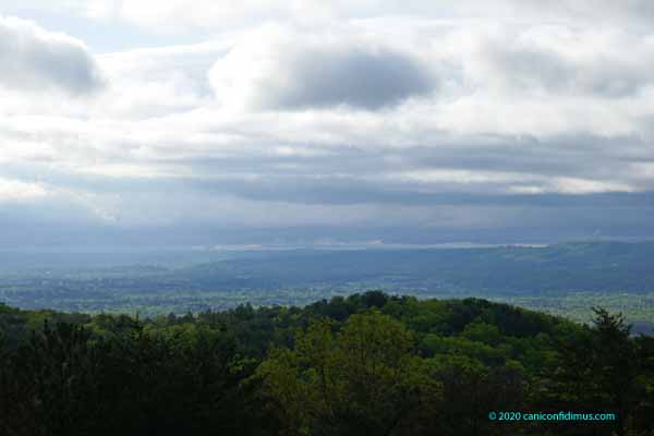
The river has another river right above it, formed by advection fog. Advection fog is usually formed by warm, humid air flowing over something that is cooler, causing some of the water vapor to condense into fog. The fog is the faint, thin, lighter line slightly under the mid-point of the image. The river is 20 to 25 miles from our house.
Many years ago when my family moved into our new house, our living room looked over fields and low hills towards the same river as it neared town. The river was probably less than two miles from our house. We often saw fog over the river then. In the more than 40 years since, the short pines in the back yard grew up and now tower over the house, completely blocking the view.
We live about 70 or 80 miles northwest of the Atlanta airport, as the crow or airliner flies, so we see a fair amount of air traffic. Passenger jets are usually still pretty high when they pass over us, so we often don’t see the airplane, only the contrail.
A few days ago the conditions were right for contrails.
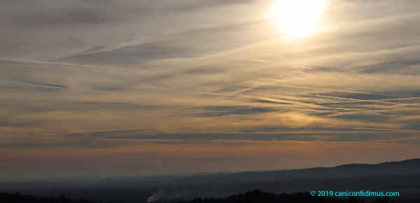
Sometimes if the air is dry, contrails don’t last long. If there is more humidity at airliner altitude, the fine particles in a jet engine’s exhaust can become condensation nuclei for water vapor, and the contrails grow.
We can also often see smoke clouds. When people clear land they sometimes make big piles of trees that they burn (with the appropriate permit). This was a particularly big and long-lasting burn.
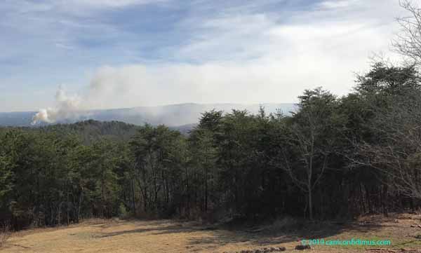
The smoke from this fire did not rise to any great altitude. In fact, it brushed the ground downwind from the fire. In air pollution meteorology, this is known as fumigating. If you have ever seen what we used to call a smoke stack at a factory or coal-burning power plant, you might have noticed how tall it is. That height is a result of a calculation made by the owners. The calculation yields a stack height that will prevent regulated pollutants from reaching a prohibited concentration on the ground downwind from the stack under most atmospheric conditions. The further downwind a smoke plume goes, the more it spreads out, both vertically and horizontally. As it spreads, the plume is diluted and the concentration of pollutants decreases. So, the stack must be tall enough that the plume is diluted enough that the pollutant concentration is below regulated standards before it reaches the ground.
If there is a strong temperature inversion, the atmosphere forms a kind of cap, so sometimes a smoke plume doesn’t rise very high. In that kind of case, the plume might reach the ground before it is diluted enough. That’s fumigation, and that is apparently what happened with the fire in this photo.
Of course, the smoke from this fire didn’t get ejected from a tall stack, it just rose from the fire. The heat of the fire is often enough to get the plume high into the atmosphere to prevent what happened here. Not so this time. So people downwind from this fire probably had a pretty unpleasant day.
Or, as it turned out, an unpleasant several days. I took this photo on December 20. On the morning of December 29, the day I wrote this, there was still a little smoke coming from this fire.
I asked John, our grader neighbor, if he knew what the source might be. He thought it came from a privately-owned dump, where John disposed of the trees he took when clearing our lot. The owner piles the trees and occasionally burns them.
Anyone burning large quantities of vegetation requires a different permit from the one I get when I burn limbs I collect from our yard. Depending on certain conditions that I’m not familiar with, large-scale burning might require the use of an air curtain destructor or incinerator. This equipment is supposed to contain smoke until it is burned, which is supposed to reduce or eliminate smoke. This burn apparently did not use one.
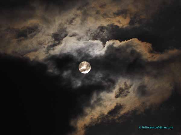
The full moon was September 13, which just happened to be a Friday. This was shortly after moonrise. It was cloudy.
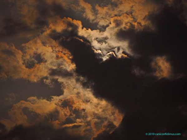
The color in the clouds was there, but not really visible to the naked eye. I let my camera take whatever exposure it wanted to. That resulted in an exposure about a second or two long, which allowed the colors to be seen in the image.
The clouds were not moving quickly, but eventually the moon came out.