I’m going to start posting our progress on the new house we intend to build. This will help us keep track of when and what we’re doing.
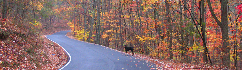
So far, I have walked the back property line, which is about 700 feet. All of the corners are marked, but the back line is thickly wooded, so it’s not possible to get a good sight line from one marker to the other. From the approximate center of the rear line, I measured to the approximate center of the property, where we want to locate the house. I also cut branches and a few small trees to make a walkable path up to the center of the lot.
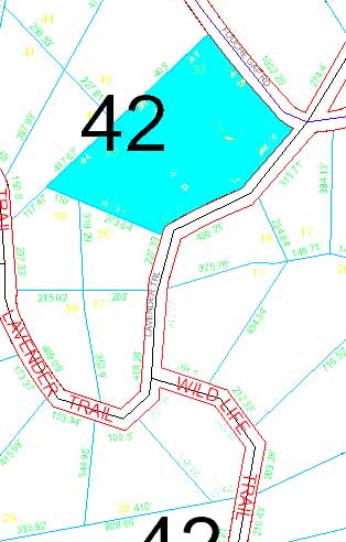
This is the property map from the Floyd County GIS site. Our new property is in blue. It totals about five acres. The map is oriented so north is up.
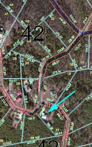
 This is the area with satellite imagery instead of line maps. The arrow is pointing to our current house.
The two southerly lots slope generally along the property lines from the back line towards Lavender Trail, the curving road in this image. The upper lot slopes down towards Lavender Trail and towards Fouche Gap Road, the road at the upper right of the image. On a sloping lot, the short axis of a house should generally be aligned with the slope. On our lot, the slope is about 40 degrees east of south. That means if we align the house with the slope, we won’t have a south-facing wall.
I have mentioned before my efforts to have south-facing glass in our current house to get the maximum solar gain in the winter. With sliding glass doors in the living room and two bedrooms, we get nice and toasty on a sunny winter day, even if the temperature is below freezing outside. We both want that in our new house, and that presents a problem.
We might get something close to what we want by making sure we have windows on the southeast-facing side and the southwest-facing side. Or we might orient the house somewhere between due south and 40 degrees east of south. But orienting the house more towards south means pushing the southeast corner further downslope. That’s what I did with our current house, and I don’t want to end up with the southeast corner of the house as far above grade as the southeast corner of our current house; that would defeat at least one of our purposes in building a new house.
Back when I was planning our current house, more than 15 years ago, you could buy books of house plans at the grocery store. I had 15 to 20 of them. These days, house plans are mostly online. Leah and I spent a while Saturday looking at some. None were exactly what we wanted, and only a few (so far) were even close. We are almost certainly going to have to modify a plan, or have a local drafter draw up plans to our specifications, as I did with our current house.
The next step for us is to map the slope. That will tell us how critical it is to keep the house oriented along the slope of the land. We won’t do anything more, including clearing for the drive and the house site, until the buyers of my mother’s house can actually get to closing.
Here is one more restriction on house location.
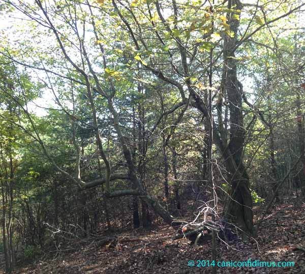
Leah and I both had the same reaction when we saw this: we have to keep this tree. Leah thinks the picture doesn’t quite capture the spirit of this tree, with two twisted main trunks and one wild trunk heading off towards who-knows-where. I haven’t decided whether it’s spooky, but I haven’t been there at night yet.
Here’s a special, bonus, trick question.
As everyone probably knows, the Earth’s axis is tilted by 23.4 degrees from “up”. That’s why we have seasons. The tropics are south of 23.4 degrees (for us in the northern hemisphere). If you go south of that, the sun will go north of straight up (the zenith) at noon in the summer. If you live north of that, the sun never gets north of the zenith at noon. If you live north of 66.6 degrees (the arctic circle), you will have some days in the winter where the sun never gets above the horizon.
So here’s the trick question: how far north do you have to go so that the sun never shines on the north side of a house oriented exactly north and south, and east and west? (Assuming the house is on flat land with nothing to provide shade anywhere near it)
I have no idea what the answer is to your question, but I love the fact that you’re going to preserve a particular tree.
Maps! I love maps. Is there a terrain version with contours and such? I like the google maps terrain depictions, but they usually aren’t as fine scale as I’d like.
Do you know what species the tree is?
As for your puzzle, as long as the sun doesn’t go north of the zenith at the mid summer point, it won’t shine on the north side. I’d guess this is at 90-23.4 or 66.6 deg latitude. Unless there’s a trick here. You wouldn’t be playing tricks, would you?
That parallel would bisect Alaska from east to west and run across the top of most of North America. It would run through the southern part of Greenland, through Iceland, and the north of Scandinavia and Russia/Siberia. It would be the Arctic Circle.
This would also be a midnight sun in June, during mid summer, but it would still shine about 1-2 hours a day at winter solstice (which I think is not really the definition of Arctic Circle).
I’ll go with Wayne’s answer on this. It sounds right! I like the idea of saving that tree. It’s been around long enough to get gnarly and have a history worth preserving. The land looks interesting, and I like how you are going to keep a journal of your plans. It will really help.
Pablo — It was kind of funny about the tree. I saw it a week or so before Leah did, and I realized it was close enough to the center of the lot that it would have to be cut if we built there. So I thought it wouldn’t hurt to move the house twenty or thirty feet away. When Leah saw it, she immediately said that we have to keep it.
Wayne — I’m not sure whether the county GIS site has contour maps, but I have found a few sources online. I plan to get Leah to help me map out the contours over a small area around where the house will go. I have been debating whether to wait until we clear that area, but I think I need to do it to define exactly where we need to clear, so we’ll probably do it in a few days. I actually noticed what species the tree is but now I have forgotten. I think it might be a maple, but I’ll have to check.
Robin — I’m going to mark the tree with green tape to make sure the bulldozer operator knows not to take that one down. He’ll take down trees all around it, but we definitely want that one to stay.
LOL, Robin, I got tricked. Or I let myself get tricked.
Mark – the best I was able to find, by googling, was a layer of old style USGS quad topos that you can download and add to google earth. Still the same light green background that it was 30 years ago. Another question would be, have you changed watersheds? I can imagine on a mountain that that might happen within short distances.
Wayne — The new property is pretty much on the same slope as our current house, although a little further around the curve of the mountain. I have noticed several fairly deep ditches, some probably four or five feet deep in places. I think it’s odd because the property is not that far from the crest. They don’t look like they carry great amounts of water any more, probably because the road construction above the property changed the drainage patterns.